


- Hexagon to Demonstrate Aviation-Focused Capabilities at FIA 2018
ATLANTA. 17 July 2018. Hexagon’s Geospatial Division, a world leader in high performance geospatial solutions, will be demonstrating the capabilities of its aviation industry solutions at the Farnborough International Trade Air Show (FIA 2018), from the 16th to the 20th July. Hexagon will be exhibiting at stand 5220 in the Aerospace 4.0 zone of the event.
Visitors at FIA 2018 will have the opportunity to see how the collaboration between borwell, QinetiQ and Hexagon’s Desktop solution, LuciadLightspeed, will provide real-time situational awareness, tracking the aircraft involved in the flying displays at the event. Representatives from borwell will be available on the stand to demonstrate the solution.
Hexagon will also be demonstrating use cases of its Luciad and Power Portfolio products, including:
- Pilot Training Simulator – experience a flight training application developed for trainee pilots using Hexagon’s Lucy solution, which is connected to Lockheed Martin’s Prepar3D. The application provides an immersive, real-life experience and allows trainees to load a flight plan and aeronautical data, onto an interactive map to be visualized alongside a virtual flight.
- Flight Planning with Lufthansa – the demonstrator shows how the impact of severe weather on Air Traffic Management (ATM) systems can be easily analyzed, to manage and re-route flights in real time, saving airlines time and money.
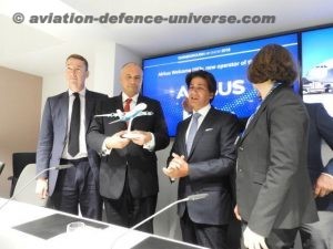
- Minimizing Airspace Conflict with Airbus Defence and Space – the CAPS (Collaborative Airspace Provision Service) application helps air traffic management (ATM) stakeholders reserve airspaces to minimize conflict with neighboring airspaces and safely plot flight paths throughout Europe.
- Analyze Motion Video from UAVs and Other Moving Vehicles – see how GeoMedia Motion Video Analyst Professional 2018 provides a complete Multi-INT solution for end-to-end management and xploitation of full motion video, imagery and feature data in a single integrated environment.
- Produce Accurate Flight Charts in Less Than 20 minutes – GeoMedia Advanced Collection provides comprehensive data capture and validation capabilities. Discover how the software supports the Multinational Geospatial Co-production Program (MGCP) and other international specification-driven collection programs.
Bart Adams, Director of Product and Innovation, Hexagon’s Geospatial Division said, “The aviation industry is undergoing significant change and innovation thanks to technological advances, and we’re delighted to be at the Farnborough Air Show demonstrating our capabilities and showcasing the ground-breaking projects we are involved in with our partners using Hexagon technology.”
Hexagon’s booth is centrally located within the new Aerospace 4.0 Zone which aims to raise awareness of the fourth industrial revolution in the Aerospace industry, and the cutting-edge technologies operating in this space.