






























- A Narrow Corridor, a Wider Strategy: India’s Northeast Security Test
- From Chokepoint to Resilience: Rethinking the Siliguri Corridor
- India Cannot Widen Geography : It Can Widen Its Options.
- Guard the Corridor, Build the Alternatives: India’s Eastern Imperative
By Jai Kumar Verma
New Delhi. October 2026 A narrow strip of land carries a vast national responsibility. The Siliguri Corridor —India’s “Chicken’s Neck”—connects the mainland with the Northeast, carrying supplies, commerce and military logistics through a geographically constrained passage. But securing this lifeline demands more than guarding its borders. Against a complex regional backdrop, India must build a network that can absorb disruption: protected infrastructure, alternative routes, dispersed supplies and dependable energy and communications. The decisive question is whether the Northeast can keep moving, functioning and receiving essential support if its principal land connection comes under pressure.
The Strategic Geography of the Chicken’s Neck
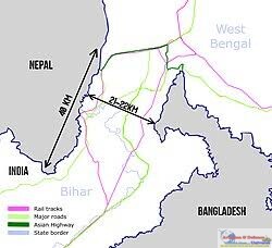
The Siliguri Corridor, a narrow land bridge in northern West Bengal, links mainland India with the Northeast. At its narrowest it is roughly 20–22 km wide. It lies between Nepal and Bhutan to the north and Bangladesh to the south, so three international borders meet around it. Its popular name, the “Chicken’s Neck”, reflects both its shape and its strategic fragility. It is the principal surface link to Arunachal Pradesh, Assam, Manipur, Meghalaya, Mizoram, Nagaland, Tripura and Sikkim.
Its importance goes well beyond the movement of people and goods. Roads and railways carry essential supplies, while the wider infrastructure network carries energy, communications and other economic lifelines. The corridor is also vital for the movement and logistical support of India’s security forces along the eastern and north-eastern frontiers. The region it serves accounts for almost eight per cent of India’s area and shares borders with five countries. A prolonged disruption would therefore affect civilian supplies, economic activity, military mobility and India’s ability to sustain its presence in the Northeast.
The surrounding strategic environment has become more complex. China’s continuing claims over Arunachal Pradesh and its military and infrastructure presence along the Himalayan frontier make the corridor central to India’s eastern security calculations. Bangladesh’s political transition has also changed the picture. Under Sheikh Hasina, India and Bangladesh cooperated extensively on connectivity, transit and security, whereas the present relationship is less predictable. Reports of Chinese assistance in developing the Lalmonirhat airfield, less than 20 km from the Indian border, have drawn attention in New Delhi. India has said Bangladesh indicated the airfield is not currently meant for military use. It is best seen as a reported strategic concern, not an established military threat.
Bangladesh: From Strategic Advantage to Strategic Uncertainty

Under Sheikh Hasina, India and Bangladesh expanded cooperation in transit, ports, railways, waterways, energy and security. The Akhaura–Agartala rail link and access to Chattogram and Mongla ports offered alternative routes to the Northeast, easing dependence on the Siliguri Corridor. Border management cooperation strengthened the wider relationship. The value of these arrangements lay in the alternatives they offered around a constrained corridor, not merely in trade. The political transition has made this equation uncertain. India cannot assume the same alignment and security cooperation will continue. That does not make Bangladesh an adversary, but it reinforces the need for multiple connectivity options.
China and the eastern strategic theatre
China is the larger strategic factor behind the vulnerability of India’s eastern theatre. Beijing continues to claim Arunachal Pradesh and refers to it as “Zangnan” or “South Tibet”, with the Tawang sector carrying particular political and strategic significance. At the same time, China has steadily expanded infrastructure and logistical capabilities across the Tibetan plateau, strengthening the PLA’s ability to move forces and supplies along the Himalayan frontier. For India, therefore, the security of the Siliguri Corridor cannot be viewed in isolation from developments along the wider eastern Himalayan frontier.
The 2017 Doklam standoff demonstrated how quickly developments in the Bhutan-China border area can acquire direct implications for India’s security. Doklam lies close to the Chumbi Valley, which projects southwards between Sikkim and Bhutan and lies in proximity to the Siliguri Corridor. India’s intervention that year followed Chinese road construction in the disputed area, which Bhutan said violated existing understandings on maintaining the status quo. The larger lesson is that India’s vulnerability is not limited to a direct attack on the corridor. It also lies in the possibility of simultaneous pressure across the Himalayan frontier, the India-Bhutan-China tri-junction and the approaches to the Northeast.
Underground and Subterranean Infrastructure
Reports point to a move towards underground military infrastructure around the Siliguri Corridor. Planned works include 12 underground Army Air Defence ammunition-storage facilities, one underground Long-Range Vector (LRV) ammunition-storage facility and 21 overground LRV emplacements, at about ₹297 crore. Their purpose is to protect critical stocks against aerial and drone attacks. Other proposals include five underground command-and-control centres, six underground communication centres, two critical storage spaces, three underground LRV ammunition-storage facilities and 12 bomb shelters, at about ₹237 crore.

These are reported proposals, not completed assets. Implementation depends on formal sanction, prioritisation and funds. Even so, their inclusion in planning signals a conceptual shift towards survivability. Ammunition, command facilities and communications located wholly above ground are vulnerable to precision strikes, drones and interdiction. Moving critical functions underground adds a layer of protection. It also reduces the risk that one surface strike disrupts ammunition, command and communications together.
The same principle applies to railways. Railway Minister has said that planning is underway for a roughly 40-km strategic stretch of underground track, along with four-lining of existing tracks, to ensure resilient passenger and freight movement. Underground rail would give one of the main arteries into the Northeast added protection and continuity. The larger point is that future conflict is unlikely to target only soldiers and bases; infrastructure itself can become a battlespace. India needs infrastructure that is efficient in peacetime and able to survive disruption in a crisis.
Highway Development and Strategic Land Management
Highway construction in the Northeast should be viewed through a strategic lens. Raising capacity in and around Siliguri matters, but so does creating multiple road alignments so that the region does not depend on a single transportation axis. Reports point to the upgrading of three lateral routes linking NH-17 and NH-27, giving additional approaches around the corridor. They also point to the upgrading of NH-10 between Sevoke and Rangpo to heavy-load defence specifications. Such routes would serve civilian and strategic needs by spreading traffic across a wider network rather than a few vulnerable arteries.
 Bridge redundancy is equally important. A resilient network needs multiple bridges and alternate crossings, backed by rapid bridge-repair capability, so that damage to one crossing does not isolate an entire area. Land management is another overlooked component. Integrated land-use planning can protect transport corridors and critical installations from unplanned development and preserve space for future expansion, so that urbanisation does not create bottlenecks.
Civil-military dual use ties these together. Infrastructure should serve commerce in peacetime while retaining the capacity and resilience to support emergency mobilisation in a crisis. West Bengal Government has also reportedly given in-principle approval to hand over seven national highway stretches to National Highways Authority of India and National Highways and Infrastructure Development Corporation Highway Development and Strategic Land Management.
Military and Air Defence Build-up
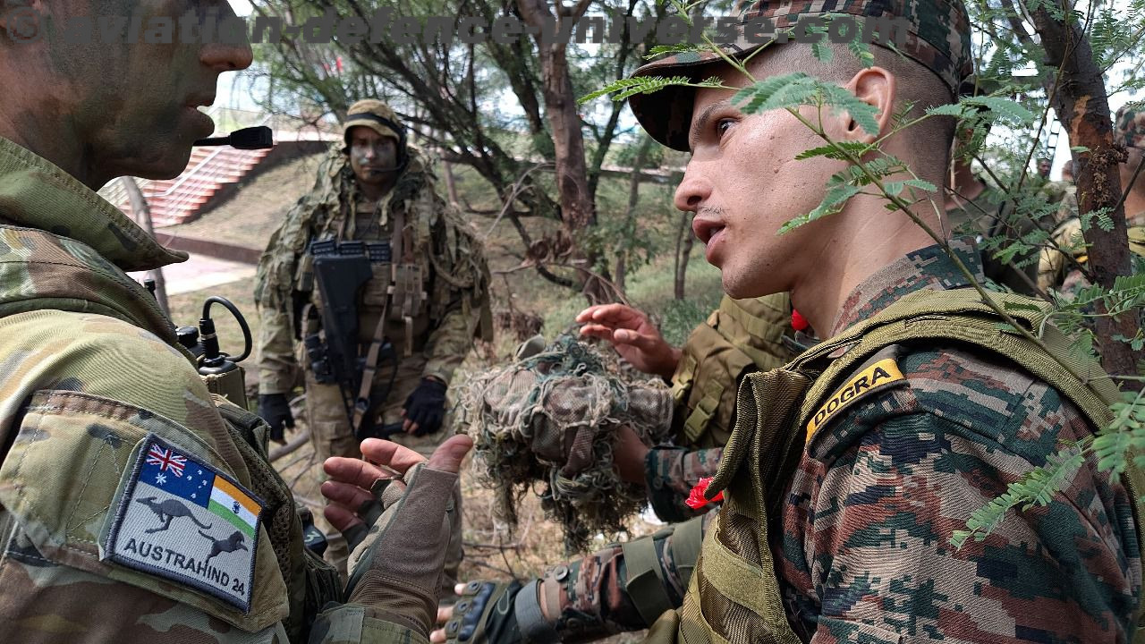
Physical infrastructure must be matched by a credible military architecture: stronger forward deployment, better mountain-warfare capability and rapid mobilisation of formations across the region.
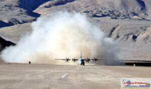
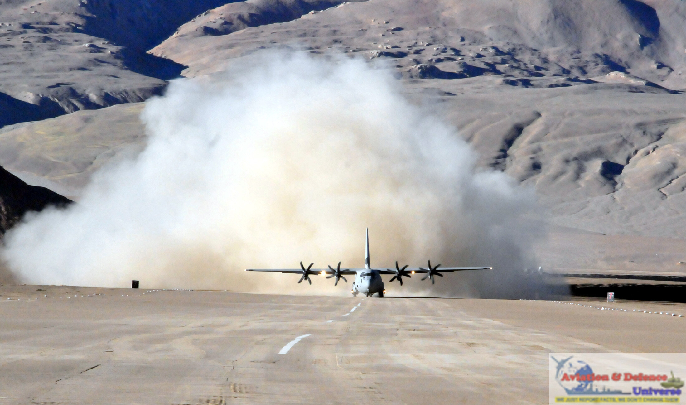
Air infrastructure is equally important. Existing airbases need continued modernisation, while additional airfields and Advanced Landing Grounds would improve operations in a difficult theatre. Hardened aircraft shelters and dispersal reduce dependence on individual airbases.
 Air defence is not a single “shield” but a layered architecture of long-, medium- and short-range systems, point defence, radar networks, electronic warfare and integrated command-and-control. The reported underground ammunition storage, protected command centres and communication facilities complement these systems by keeping critical support functional during sustained attacks. Counter-drone capability will also be essential, with detection systems, electronic countermeasures and interception capabilities protecting both military installations and critical civilian infrastructure.
Tactical Mobility and Distributed Military Presence
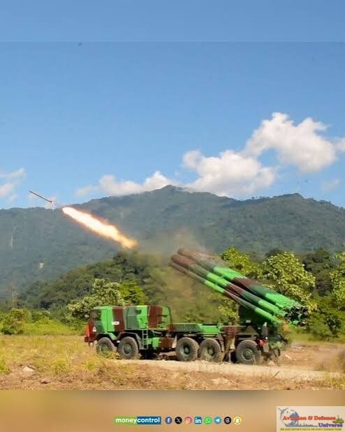
India’s objective should not simply be to add troops and equipment in the Northeast, but to make them harder to neutralise and faster to reposition. Mobile missile and air-defence systems, electronic-warfare assets, surveillance platforms, engineering units, rapid-reaction forces and specialised mountain formations offer more flexibility than reliance on fixed installations. This reflects the principle of mobility, dispersion and survivability.
Distributed deployment likewise reduces the risk of concentrating critical assets around a few major bases. A wider network of facilities improves survivability, response times and coverage of vulnerable sectors. Reports from November 2025 said the Army had set up three new garrisons near the corridor, in Assam, Bihar and West Bengal. Such a network also supports distributed command-and-control, so operations can continue even if individual installations are damaged.
Redundancy and Logistics Resilience
What if the Siliguri Corridor itself comes under sustained disruption? Defending it more aggressively is not enough; the Northeast must keep functioning even if parts of the corridor are disrupted. This requires strategic redundancy: multiple transportation routes, alternative railway lines, secondary roads, several fuel depots, decentralised ammunition storage, redundant telecommunications, multiple power-supply routes and emergency logistics hubs. No single strike should paralyse the logistics chain. The reported underground ammunition storage and protected military facilities fit this concept, dispersing and protecting critical stocks and command infrastructure instead of concentrating them in a few exposed locations.
Logistical Decentralisation
Logistical decentralisation should therefore be treated as a distinct objective. Instead of concentrating critical supplies in a small number of large depots, distributed logistics nodes can be developed across the Northeast. Fuel, ammunition, food, medical supplies, engineering equipment, spare parts and emergency bridging equipment can be positioned at multiple locations, subject to appropriate security and logistical considerations.
This approach complements underground storage. Underground infrastructure provides protection; decentralisation provides redundancy. Together, they reduce the possibility that a single successful attack could generate cascading logistical failure.
Alternative Routes and the Eastern Connectivity Architecture
Long-term resilience also requires India to look beyond the Siliguri Corridor itself. Connectivity through Bangladesh offers one of the most important possibilities. Rail and road links through Bangladesh, access to ports such as Chattogram and Mongla, and connectivity projects such as the Akhaura-Agartala route can provide additional avenues for civilian and commercial movement into the Northeast.
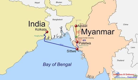
The Kaladan Multi-Modal Transit Transport Project provides another alternative connectivity concept, linking India’s Northeast with the Bay of Bengal through Myanmar. Air connectivity provides another layer. Civilian airports, military airfields and Advanced Landing Grounds, supported by strategic airlift capabilities, can provide alternatives when surface connectivity is disrupted. Where geographically and economically feasible, riverine connectivity can add another layer to the regional transportation network. These alternatives should not be seen as replacements for the Siliguri Corridor. Rather, they should ensure that the corridor does not remain the only indispensable artery.
The Bhutan Dimension
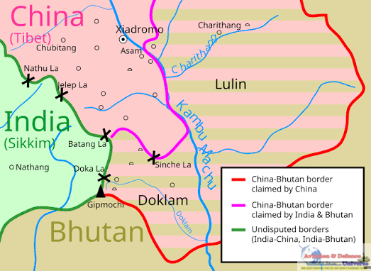
The strategic environment around the corridor also cannot be examined without considering Bhutan. The country’s geographical position places developments along the Bhutan-China boundary, particularly around the Doklam region and the strategically significant Chumbi Valley, within India’s broader security calculations. The objective should not be to treat Bhutan as an extension of India’s defence architecture. Rather, developments in the Bhutan-China border region need to be incorporated into India’s assessment of the wider strategic environment surrounding the Siliguri Corridor. The proximity of the Chumbi Valley to the corridor demonstrates why developments beyond India’s immediate territorial boundaries can have direct implications for its strategic planning.
Technology, Surveillance and Intelligence
Modern defence of the Northeast cannot rely solely on physical fortifications. Persistent surveillance and timely intelligence are equally important. Satellites, unmanned aerial systems, high-altitude surveillance, ground-based radars, electronic intelligence and secure communications can collectively provide a more comprehensive understanding of developments across the region. AI-assisted surveillance and battlefield-management systems can further improve the speed with which information is processed and transmitted to decision-makers. The objective should be the creation of a persistent surveillance architecture capable of identifying emerging threats and infrastructure vulnerabilities before they develop into major crises.
Energy and Telecommunications Resilience
Strategic resilience also extends to energy and digital connectivity. Multiple transmission lines, distributed generation capacity, renewable sources and backup systems can reduce dependence on individual power installations. Critical substations and other components of the electricity network also require appropriate protection and redundancy.

Telecommunications require similar treatment. Fibre-optic redundancy, satellite communications, secure military networks and multiple terrestrial routes can ensure that the Northeast does not lose digital connectivity merely because one physical corridor is disrupted.
In a modern conflict, communications failure can have consequences comparable to physical infrastructure damage. Therefore, digital resilience must be treated as an element of national security.
Civilian Infrastructure as Strategic Infrastructure
Perhaps the most important policy shift is to stop viewing infrastructure development and strategic security as separate domains. Railways, highways, airports, bridges, telecommunications and energy networks are civilian assets during normal times, but they can also provide strategic mobility and national resilience during a crisis.
The infrastructure proposals emerging around the Siliguri Corridor illustrate this dual-use approach particularly well. The proposed underground railway, expanded surface connectivity, lateral highway links and protected military infrastructure have civilian as well as strategic utility. The Union government’s emphasis on the 40-km underground rail corridor reinforces the broader importance being attached to resilient connectivity with the Northeast.
India’s infrastructure policy in the Northeast should therefore increasingly follow a dual-use model. New infrastructure should be designed with adequate capacity, connectivity and resilience to support both economic development and emergency requirements.
From Protection to Resilience: Strengthening India’s Strategic Depth in the Northeast
The strategic importance of the Siliguri Corridor cannot be addressed merely by adding troops or roads. The changing character of warfare requires India to treat the Northeast as an integrated system in which transportation, communications, energy, logistics, military infrastructure and civilian connectivity are interconnected. The question is not simply how India defends the Chicken’s Neck, but how it ensures the corridor can never become a single point of strategic failure. India’s doctrine must therefore move from protection to resilience, through three layers.
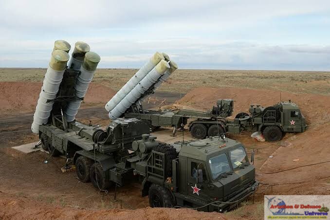
First, protect the corridor: through air defence, military deployment, surveillance and hardened infrastructure. Second, make disruption difficult: through redundancy, dispersal, alternative road and rail alignments and resilient logistics. Third, make disruption less consequential: through connectivity with Bangladesh and Myanmar, air and river networks, distributed logistics and diversified energy and communications.
The reported underground defence proposals add another layer between critical military capabilities and potential attack. But they remain proposals or planning-stage initiatives, not operational facilities. Their significance lies not in suggesting that the corridor has become an underground fortress, but in showing the direction of India’s strategic planning.
The objective is not an impregnable corridor, since no modern infrastructure is completely invulnerable. It is a network in which damage to one component does not mean strategic paralysis. That is the essence of resilience, and for India’s Northeast it may prove more important than physical protection alone.
The Siliguri Corridor will remain geographically important because geography cannot simply be wished away. Yet geographical vulnerability need not translate into strategic vulnerability. India must therefore move beyond a doctrine centred only on guarding the “Chicken’s Neck” towards one built on strategic resilience. The objective should be to ensure that even if the corridor faces disruption, the Northeast continues to receive troops, fuel, food, electricity, communications, commercial supplies and essential services through alternative and protected networks. This requires a combination of hardened infrastructure, dispersed logistics, redundant transportation, alternative connectivity and resilient energy and communication systems. The ultimate goal is not to make the corridor impregnable, but to ensure that its disruption does not paralyse the Northeast. In that sense, the Chicken’s Neck must become one component of a larger, redundant national connectivity architecture, rather than a single point of strategic failure.
India cannot redraw the geography of the Chicken’s Neck, but it can reduce the consequences of its vulnerability. Protecting the corridor must go hand in hand with diversifying transport routes, dispersing critical supplies and strengthening power and communications networks. Proposed underground facilities may add protection if implemented; lasting resilience will depend on how effectively the wider system works together. The goal is clear: damage to one route or installation must not halt military mobility, civilian life or economic activity across the Northeast. The corridor will remain narrow. India’s options must grow wider.
(Jai Kumar Verma is a Delhi-based strategic analyst and Life Member of United Services Institute of India and member of The Manohar Parrikar Institute for Defence Studies and Analyses. The views in the article are solely the author’s. He can be contacted at editor.adu@gmail.com)











































































-A4-Size-(2)_page-0001.jpg)