


- Cyprus’ divided capital has the longest existing UN post
By Chaitali Bag
Larnaca, Cyprus. 18 February 2020. Deserted buildings , bullet holes on the walls, screaming silence and troops manning the buffer zone which is the no-man’s –land between Northern and Southern part of Cyprus, seem to have frozen in time. It is the peace keeper of the world United Nations Organisation which also keeps peace in the last divided capital of the world- Nicosia, thus making Cyprus a unique nation and a sought after destination to live this piece of history .
Nicosians woke up on 20th July 1974 to the sounds of gunfire, explosions , low flying aircrafts creating a fear and nothing was same after that. It was Turkey having invaded which ended almost a month later on 16 August till when the then, Turkish forces occupied just over a third of the island in the name of a Turkish Cypriot minority not quite a fifth of its total population. A decade of sporadic inter-communal violence between the islands Greek Cypriots and Turkish Cypriots resulting from the constitutional breakdown of 1963 ended with Turkey invoking its role as a guarantor under the 1960 Treaty of Guarantee in justification for occupying Northern Cyprus. Turkish forces invaded the island in two waves, occupying 37 percent of the island’s territory in the north-east. Operation Atilla, as was codenamed by Turkish army for this invasion ironically is also known as Kıbrıs Barış Harekâtı, . ‘Cyprus peace operation’. War can never be peaceful and those who had to leave their homes all of the sudden just to save their lives this nomenclature is truly ironic.
The operation led to the widespread displacement of Cyprus’s ethnic communities, dividing the island between a Turkish Cypriot north and Greek Cypriot south. In the aftermath of the invasion, Turkish Cypriots declared a separate political entity in the form of the Turkish Federative State of Cyprus and by 1983 made a unilateral declaration of independence as the Turkish Republic of Northern Cyprus, which was recognized only by Turkey. The United Nations recognizes the sovereignty of the Republic of Cyprus according to the terms of its independence in 1960. UN peace-keepers maintain a buffer-zone between the two entities.
Nicosia, also known as Lefkosia, is the last divided capital in the world. It is a historical city with walled old town and gorgeous landmarks, but brutally split in two with a border zone, a wall that symbolizes the crisis that still today keeps the two sides of Cyprus apart. One half of the capital belongs to the Republic of Cyprus, another to the self-proclaimed Turkish Republic of Northern Cyprus. The Green Line is still today a demilitarized border zone, patrolled by the UN Peacekeeping Forces, and it splits the island and it’s capital city into two separate parts. TRNC is only recognized as an independent country by Turkey, and thus officially considered as part of the Republic of Cyprus. But in practice, these two parts of Cyprus are quite different worlds.
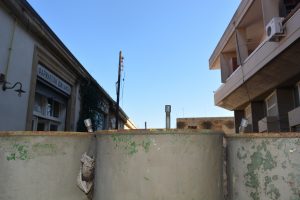
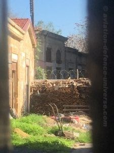
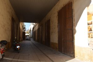
The medieval old city of Nicosia is circulated by the Old City Walls. It has seen the rise and fall of several civilizations, and has footprints from the Lusignan, Venetian, Ottoman and British periods. The Old Town is full of historical treasures, most of them well preserved. It has a glorious face of a city from the Middle Ages, but it also has the face of the war; the Green Line divides also the walled old town in two parts, and the border zone itself is a confusing and sad sight. It is a line of abandoned buildings, that can be partly on one side, partly another, with bullet holes in the walls. It is a line with barricades, barbed wires, guards and surveillance systems. It surely makes Nicosia a unique capital.
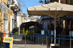
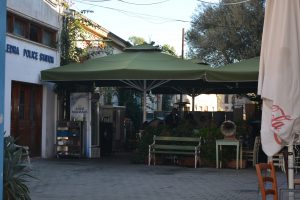
Crossing the border between Cyprus and North Cyprus has been straight-forwarded since 2003, when Cyprus prepared to join the EU. After presenting your passport you can simply walk over the border. There are several crossings points around the island, and one for pedestrians’ right in the old town of Nicosia. In most of the crossings points it’s also possible to cross with a car. The Ledras Street border crossing inside the walled city is very popular among both locals and tourists, and the easiest way to see both sides of the old Nicosia. When crossing from south, you need to show your passport to Greek side police officers, then walk the short distance to another passport check point in north side. The city wall that circulates the old town has three gates in southern Nicosia; the Paphos Gate, the Famagusta Gate and the Kyrenia Gate.
The last round of Cyprus’s drawn-out peace process ended in April 2004 when the Greek Cypriot community, which had long advocated reunification of the divided island on a bi communal and bi zonal basis, overwhelmingly rejected the UN-sponsored “Annan Plan”, which provided for just that. At the same time on the northern side of the Green Line, the Turkish Cypriot community, in a major reversal of its traditional preference for secession, backed reunification. The failure of the referendum did not stop a still-divided Cyprus being admitted to membership of the EU a week later.
The United Nations Buffer Zone in Cyprus is a demilitarized zone, patrolled by the United Nations Peacekeeping Force in Cyprus (UNFICYP), that was established in 1964 and extended in 1974 after the ceasefire of 16 August 1974, following the Turkish invasion of Cyprus, and the de facto partition of the island into the area controlled by the Republic of Cyprus (excluding the Sovereign Base Areas) and the unofficial Turkish Republic of Northern Cyprus in the North. The zone, also known as the Green Line stretches for 180 kilometres (112 miles) from Paralimni in the east to Kato Pyrgos in the west, where a separate section surrounds Kokkina.
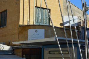
The headquarters of the United Nations Force in Cyprus (UNFICYP) and the headquarters British contingent are located within the United Nations Protected Area (UNPA) on the west side of the city of Nicosia, approximately five kilometres from the city centre. The UNPA is located within the buffer zone in the area of the now disused Nicosia international airport. Mostly open scrub land, the area is dotted with small groups of used buildings as well as many disused structures, formerly part of the airport. The Kyrenia mountains can be seen to the north of the UNPA and the Troodos mountains to the south.
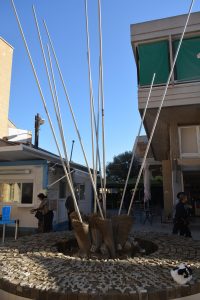
Since the fall of the Berlin Wall, this no man’s land in Cyprus is the world’s last divided capital. Barbed wire and a sentry post with flags in the background at the United Nations buffer zone in Nicosia have stories waiting to be told. This is the first in the series.